
Aguait des Gran Canal Viewpoint near Platja de Muro
.jpg)
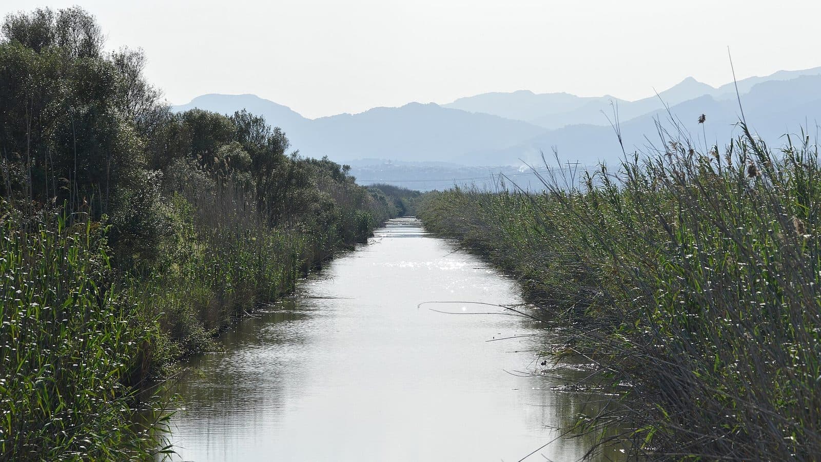
Between the long sandy beach of Platja de Muro and the wetlands of s’Albufera, Aguait des Gran Canal draws attention to a feature that continues to shape the landscape today: the Gran Canal. The viewpoint is not solely about a sweeping panorama, but about looking closely. Here, the waterway, coast and flat hinterland can be understood as parts of a connected landscape.
The Gran Canal was part of attempts to drain and reclaim the marshland of s’Albufera. The straight waterway meets surroundings whose character continues to be shaped by water.
Aguait des Gran Canal is particularly worthwhile for visitors who want to discover Platja de Muro beyond sun loungers and hotels. Nature lovers will find it a fitting start or finish to an excursion to s’Albufera, while walkers can combine the stop with the coast. As a destination in its own right, the visit remains manageable, but it becomes considerably more rewarding when there is time to observe and understand the setting.
What to See
The Gran Canal
The main focus is the Gran Canal itself. It runs from the island’s interior through the water-shaped plain and reaches the coast at Platja de Muro. In other parts of the resort, sand, hotels and beach activities dominate; here, by contrast, the engineered side of the landscape comes to the fore. The canal is a reminder that it served to drain the marshland in the hinterland.
Its purpose was to drain the marshland that is now home to the s’Albufera nature park. This original function is precisely what makes the view interesting: what may initially look like a simple waterway is a visible connection between the wetlands and the sea. Following its course with your eyes makes it easier to understand why the canal remains a prominent line for orientation in Platja de Muro today.
The Landscape of s’Albufera
Beyond the canal, there is no classic mountain or rocky coastline. The terrain is flat, and the landscape’s appeal comes from the transitions between bodies of water, wetlands, dunes and the developed coast. S’Albufera is one of the Balearic Islands’ most important wetland landscapes; around Platja de Muro, it forms a striking contrast to the tourist-oriented strip along the beach.
From Aguait des Gran Canal, it is primarily this connection that becomes clear. The viewpoint is no substitute for a longer route through the nature park. Instead, it works like a window onto its water system: the Gran Canal directs the gaze into the plain, while the nearby coast explains where this water flows. The experience therefore depends less on a single spectacular sight than on the opportunity to interpret the landscape at a leisurely pace.
Platja de Muro and the Coast
Platja de Muro stretches along the Bay of Alcúdia and is divided into several beach sections. Around the Gran Canal, two very different sides of the resort meet. On one side lies the open coast with its gently shelving sandy beach; on the other is the wet hinterland of s’Albufera. Between them, the canal runs as a clearly visible axis.
This contrast is the viewpoint’s defining feature. Aguait des Gran Canal is a place for observing the landscape: water flow, coastline and wetlands come together in a perspective that is easily missed during a simple beach visit.
Visiting the Viewpoint
Get Oriented, Then Observe
A visit is best started with the canal. Instead of immediately looking for a single photo opportunity, it is worth first following its direction: inland it points toward s’Albufera, while toward the coast it leads in the direction of the sea. This simple orientation makes it clear why the viewpoint is located precisely here. Only then do the smaller differences between the engineered waterway and the natural wetland landscape become more apparent.
The stop can be brief if Aguait des Gran Canal is simply a station on a walk. More time is worthwhile for anyone who wants to observe changes on the water or in the surrounding landscape. A fixed length of stay would therefore be of little help: the site works both as a peaceful stop along the way and as a starting point for a more extensive exploration of the area.
A Destination Without an Extensive Sightseeing Program
The value of the visit lies in the perspective it offers on the canal and its surrounding landscape. This also makes the destination suitable for travelers who do not want to add a lengthy activity between a beach day and the nature park.
The visit is especially rewarding when it is not treated in isolation. A walk along the coast afterward shows how quickly the scenery changes from wetlands to holiday beach. In the other direction, a visit to s’Albufera deepens the understanding of the landscape from which the Gran Canal comes. In this way, a small viewpoint becomes a useful key to the geography of Platja de Muro.
Getting There and Parking
From Palma Airport
The route from Palma Airport to Platja de Muro covers 62 kilometers by road. The drive takes around 53 minutes and follows the Ma-30, then the Ma-13 and finally the Ma-3470 to the north of the island. These details apply as far as Platja de Muro, not directly to the viewpoint. Within the resort, the final stretch follows local roads toward the Gran Canal and s’Albufera.
For navigation, use the full name Aguait des Gran Canal.
From Palma
From the center of Palma, Platja de Muro is 59 kilometers away by road. The drive takes around 56 minutes and follows the Ma-13 and Ma-3470. The Ma-13 covers most of the route toward the north of the island, while the Ma-3470 continues into the area around the Bay of Alcúdia and Platja de Muro.
Here too, the distance and driving time refer to Platja de Muro. For the final stretch, use the Gran Canal or the s’Albufera nature park for orientation. The exact local position should be checked in the navigation system before departure. This avoids being directed only to the center of the resort.
By Bus
The stops S’Albufera 1 and S’Albufera 2, as well as Los Troncos 1 and Los Troncos 2, are located around s’Albufera and Platja de Muro. Which one is most convenient for a particular connection depends on the direction of travel and the current route. From the stop, the final stretch leads through the flat coastal zone to the area around the Gran Canal.
Traveling by bus is particularly suitable when combining the viewpoint with a walk, the nature park or the beach. Nevertheless, the current timetable and exact walking route should be checked before departure. Platja de Muro extends along the coast, so a stop with a suitable name is not necessarily located immediately beside Aguait des Gran Canal.
Bus lines to Aguait des Gran Canal at a glance
| Line | Route | Departures/day | First | Last |
|---|---|---|---|---|
| 324 | Can Picafort - Alcúdia | 429 | 00:01 | 23:56 |
| 302 | Can Picafort - Palma | 276 | 00:10 | 23:53 |
| 315 | Sa Pobla - Badia d'Alcúdia | 126 | 06:41 | 23:39 |
| A32 | Can Picafort - Aeroport | 104 | 00:15 | 23:32 |
| 325 | Alcúdia - Cala Rajada | 65 | 08:35 | 22:24 |
From the official GTFS feeds (TIB/SFM), no real-time data. The figures cover all stops in the town; weekend and holiday services differ — check with the operator before travelling.
Getting there by bus
S'Albufera 2 (39007) · 1.5 km as the crow flies
- 302Can Picafort - Palma · Daily
- 315Sa Pobla - Badia d'Alcúdia · Daily
- 324Can Picafort - Alcúdia · Daily
- 325Alcúdia - Cala Rajada · Daily
- A32Can Picafort - Aeroport · Daily
S'Albufera 1 (39006) · 1.5 km as the crow flies
- 302Can Picafort - Palma · Daily
- 315Sa Pobla - Badia d'Alcúdia · Daily
- 324Can Picafort - Alcúdia · Daily
- 325Alcúdia - Cala Rajada · Daily
- A32Can Picafort - Aeroport · Daily
Las Gaviotas 2 (39012) · 2.1 km as the crow flies
- 302Can Picafort - Palma · Daily
- 315Sa Pobla - Badia d'Alcúdia · Daily
- 324Can Picafort - Alcúdia · Daily
- 325Alcúdia - Cala Rajada · Daily
- A32Can Picafort - Aeroport · Daily
Las Gaviotas 1 (39013) · 2.1 km as the crow flies
- 302Can Picafort - Palma · Daily
- 315Sa Pobla - Badia d'Alcúdia · Daily
- 324Can Picafort - Alcúdia · Daily
Els Pins 1 (39005) · 2.1 km as the crow flies
- 302Can Picafort - Palma · Daily
- 315Sa Pobla - Badia d'Alcúdia · Daily
- 324Can Picafort - Alcúdia · Daily
- 325Alcúdia - Cala Rajada · Daily
- A32Can Picafort - Aeroport · Daily
Els Pins 2 (39004) · 2.1 km as the crow flies
- 302Can Picafort - Palma · Daily
- 315Sa Pobla - Badia d'Alcúdia · Daily
- 324Can Picafort - Alcúdia · Daily
- 325Alcúdia - Cala Rajada · Daily
- A32Can Picafort - Aeroport · Daily
Timetable data: official GTFS feeds (TIB/EMT), no real-time — check with the operator before travelling.
Nearby
Platja de Muro
Platja de Muro is a relatively young holiday resort on the Bay of Alcúdia. Its long, gently shelving sandy beach is accompanied by clear, generally calm coastal waters and is particularly popular with families. Parts of the hinterland are characterized by hotels and holiday complexes, while dunes and less developed coastal landscapes have been preserved along other sections.
The area around the Gran Canal marks a striking transition within this long beach resort. Here, the hinterland reaches all the way to the coast, making the connection with s’Albufera visible. A beach walk before or after the visit therefore reveals more than just the bay: it shows how closely the tourist resort, dune zone and wetlands lie alongside one another.
s’Albufera Nature Park
S’Albufera is the most obvious addition to a visit to Aguait des Gran Canal. The wetlands lie behind the coastal strip and are shaped by waterways, open areas and vegetation. While the viewpoint focuses attention on a central water connection, the nature park reveals the broader landscape behind it.
The order can be chosen according to personal interest. Those who stop at Aguait des Gran Canal first receive a clear introduction to the canal’s role. Those arriving from s’Albufera can see at the viewpoint how the water system continues toward the coast. In both cases, the combination helps visitors understand the Gran Canal not as an isolated ditch, but as part of a much larger wetland landscape.
Bay of Alcúdia
The Bay of Alcúdia forms the broad coastal setting of Platja de Muro. Toward Port d’Alcúdia, tourist development increases; toward the quieter beach sections, dunes and less densely developed areas become more prominent. An excursion does not need to become an extensive sightseeing program. Simply combining Aguait des Gran Canal, a section of beach and a detour to s’Albufera reveals three very different sides of the island’s north.
This is precisely where the strength of this small destination lies. Aguait des Gran Canal does not compete with old towns, museums or large viewing terraces. It focuses attention on a landscape boundary where the sea, holiday resort and wetlands meet directly.