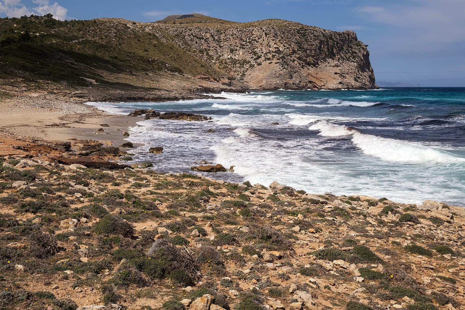
Arenalet Verger beach, Mallorca

Places to stay near Arenalet Verger
AdTo load the accommodation map by our partner Stay22, we need your consent for marketing cookies. Your consent applies to all marketing content on mallorca.com.
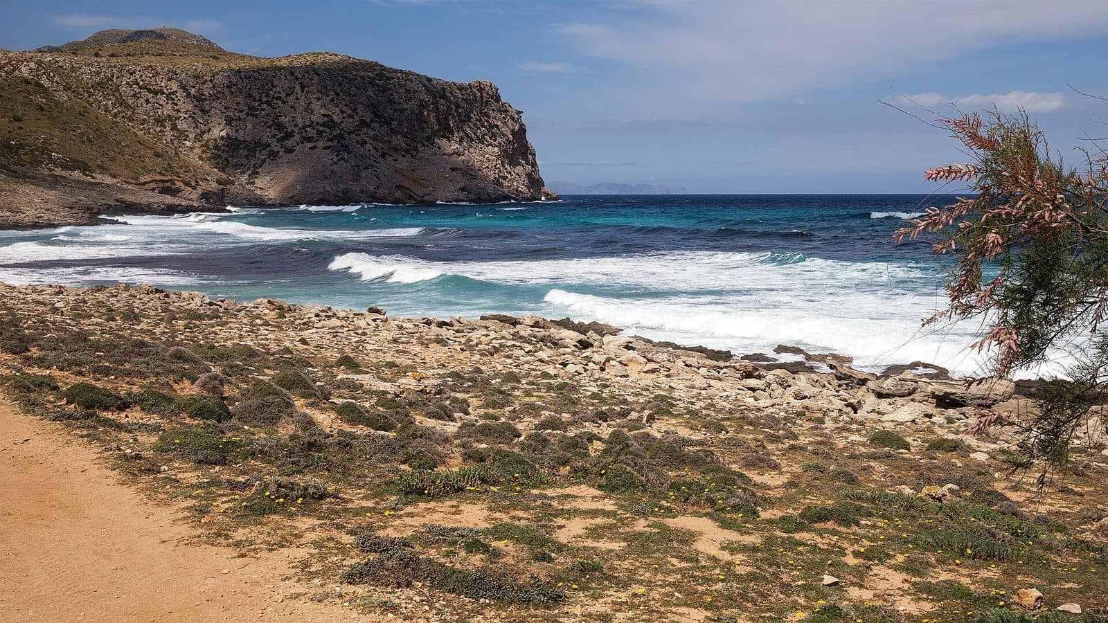
Arenalet Verger is not a beach for a spontaneous swim stop, but the destination of a substantial coastal hike. Also known as S’Arenalet des Verger or S’Arenalet d’Aubarca, this sandy beach lies on Mallorca’s rugged northeastern edge in the Península de Llevant Natural Park. Hotels, beach bars and roads end long before the bay. Instead, protected landscapes, rocky sections of trail and neighbouring natural coves accompany you to an open shoreline of pale sand dotted with individual boulders.
It is precisely this combination of hiking destination and swimming spot that distinguishes Arenalet Verger from more easily accessible beaches around Cala Mesquida and Cala Ratjada. According to the Balearic beach catalogue, the beach is 130 metres long and 40 metres wide. In calm weather, the sea appears clear and the entry is predominantly sandy, but the bay is exposed to winds from the north. There is no shade or reliable beach service. You should therefore bring sturdy footwear, enough water, food and full sun protection. If you take the route and exposed setting seriously, you can experience a beach day where getting there is at least as important as swimming.
Where is Arenalet Verger beach, Mallorca, and what is it like?
Arenalet Verger lies on Mallorca’s northeastern coast in the Península de Llevant Natural Park. The Balearic beach catalogue lists Cala Mesquida as the location and gives a distance of 12.5 kilometres from Artà; the official tourism address assigns the beach to Artà. The bay is far from the developed coastal resorts, on the grounds of the possessió Aubarca.
The name appears in several forms: S’Arenalet des Verger, S’Arenalet d’Aubarca, S’Arenalet d’Albarca and, in shortened form, S’Arenalet. They all refer to the same secluded sandy beach between the area around Cap Ferrutx and Sa Font Celada. The Balearic beach catalogue traces the word Aubarca back to the Arabic “al-Bascat”, meaning “shore”.
Low vegetation, hills and protected parkland shape the landscape directly behind the coast. Spurge grows on the beach, while several larger boulders lie in the central area. Trails and sensitive areas of vegetation are signposted in places. Stay on the designated paths and avoid unnecessarily entering vegetated areas.
| Feature | Details |
|---|---|
| Beach type | Sandy beach |
| Length | 130 m |
| Width | 40 m |
| Seasonal occupancy | high |
| Nature reserve | yes |
| Marine reserve | yes |
| Distance from Artà | 12.5 km |
| Walking distance from Cala Torta | about 5.5 km |
The occupancy rating requires some context: the Balearic beach catalogue classifies it as high during the season, while also describing Arenalet Verger as one of Mallorca’s least visited beaches. The long walk acts as a natural filter. You should therefore expect neither complete solitude nor the typical conditions of a busy holiday beach.
How do you get to Arenalet Verger?
The most practical way to reach Arenalet Verger is on foot or by bicycle; there is no direct, reliably accessible road for cars leading to the beach. The Balearic beach catalogue explicitly warns of difficult access across private property and closed barriers along the final 5.5 kilometres.
A common option begins at Cala Torta or in the Cala Estreta area. From there, the old coastal and boundary trail leads via Cala es Matzoc and Sa Font Celada to Arenalet Verger. The roughly 5.5-kilometre route from Cala Torta is estimated to take approximately one and a half to two hours each way. Walking time may be longer depending on your chosen starting point, route and pace.
The coastal trail is not a continuously comfortable promenade. It includes rocky, uneven sections and smaller ascents and descents. In parts, the path can be difficult to identify. Suitable footwear and a route planned in advance are therefore more important than beach sandals.
Alternatively, you can take an inland route from the S’Alqueria Vella visitor centre through the natural park and the former Es Verger estate towards the coast. For access to the park from Artà, the Balearic tourism information service recommends the road towards the chapel of Betlem: turn right at the park entrance at kilometre 4.7.
Warning: Do not attempt to bypass closed barriers or private property by car. Plan Arenalet Verger as a hiking destination and allow enough daylight for the entire return journey.
Where can you park?
You do not park at the beach, but at a permitted starting point for the hike. Options mentioned include the park entrance on the road towards Betlem, the area around Cala Torta and the Cala Estreta area.
According to the Balearic tourism information service, parking is possible at the natural park entrance at kilometre 4.7 on the road towards the chapel of Betlem. For the coastal route, the Cala Torta car park is frequently mentioned as a starting point. Another route description begins at Cala Estreta and notes parking options there.
The access roads to Cala Torta and Cala Estreta may deteriorate as you approach the coast. More importantly, the actual route to Arenalet Verger should not be treated as a normal road for cars. Because of private property and barriers, the Balearic beach catalogue explicitly recommends travelling on foot or by bicycle.
The number of available spaces and which access roads are currently open may change. Check the signs, do not block any barriers and be prepared to stop before reaching your preferred starting point.
Note: Do not leave supplies that you will need during the day in the car. Several kilometres separate the car park from the beach, and you cannot buy drinks or food at the bay.
What are the sand, water and swimming conditions like?
Arenalet Verger has pale, fine sand, a predominantly sandy entry and a shallow sandy seabed close to the shore. However, boulders lie in the middle of the broad shoreline, while the areas at either end may be rockier.
In calm weather, entering the water over the sandy area is relatively straightforward. However, the bay is open and not as sheltered as many small calas. Winds from the northwest, north and northeast in particular can create waves and significantly change the conditions. There is no lifeguard.
The seabed remains sandy across a larger area and is initially not very deep. Even so, you should not mistake this for consistently safe swimming conditions: wind, waves and the isolated setting require careful assessment. If the sea looks rough, you should avoid swimming or remain close to the shore.
A mask and snorkel can be worthwhile on a calm day. The Balearic tourism information service describes seabeds with diverse marine life here. Water shoes can be comfortable around the rocky edges; they are normally not essential in the central sandy entry area.
For small children, the sand is not the only consideration. The long walk there and back, lack of supervision, limited shade and possible waves make Arenalet Verger primarily a destination for families with hiking experience who can carry their own equipment. The route is unsuitable for pushchairs or people with limited mobility.
What facilities are available at the beach?
There are no standard beach services directly at Arenalet Verger: no sun loungers, parasols, beach bar, water sports station or supervised swimming area. No rubbish bins are listed for the beach either, so you must take your waste away with you.
The Refugi de s’Arenalet, a simple accommodation facility in the natural park managed by IBANAT, stands nearby. Overnight stays must be booked in advance. Day visitors should not consider the refuge part of the regular beach infrastructure; prepare for a day without freely available services.
Natural shade is extremely limited. A few more sheltered spots may be found behind low vegetation, but there are no reliable shaded areas on the open sand. Bringing your own lightweight sun shelter can be useful, provided you can carry it throughout the hike and do not damage any vegetation.
There are also no shops or restaurants at the destination. Water and provisions therefore belong in your backpack from the outset. The tourism information service for eastern Mallorca recommends at least two litres of water per person in summer. Also bring food that can withstand the heat and being carried in a backpack.
When is the best time to visit, and how busy does it get?
The best option is to start in the morning on a day with stable weather, moderate temperatures and little wind. This allows you to complete a large part of the route before the strongest midday heat and leaves enough time for a beach break and the return journey.
The trails and beach are largely exposed to the sun. At midday and in the early afternoon, the heat and lack of shade can make the hike considerably more strenuous. A later visit is possible, but requires especially careful timing so that you do not have to cross rocky or poorly marked sections of trail after dark.
There are two important points regarding visitor numbers: the Balearic beach catalogue lists high seasonal occupancy, while also describing the beach as particularly secluded and little visited. Hikers from the Refugi, day visitors and occasional small boats can nevertheless gather in the bay. On a shoreline only 130 metres long, even a modest number of people may already be noticeable.
The hike can be more pleasant outside periods of intense heat. Regardless of the season, you should check the wind and weather: the exposed northeastern coast is sensitive to winds from the north, and the return route remains several kilometres long even after a calm beach visit.
What can you see around Arenalet Verger?
The route connects Arenalet Verger with several natural coves and the historic Torre des Matzoc. The coastal trail passes Cala Estreta, Cala es Matzoc and Sa Font Celada, among other places.
The round watchtower is particularly striking and is known variously as Torre des Matzoc, Torre d’Aubarca, Torre de sa Falconera or Torre de Sant Ferran. It was built in 1751 as a defensive and observation tower to protect the coast and, according to the Balearic beach catalogue, stands 67 metres above the sea.
From Cala es Matzoc, the path climbs to the tower and then continues towards Sa Font Celada. This neighbouring sandy cove lies only a short stretch of coast before Arenalet Verger. On a circular hike from Cala Estreta, you can combine both coves and the tower; even without a long beach break, you should allow several hours.
Farther offshore lies Faralló d’Aubarca. The Balearic beach catalogue places this rock formation 0.4 nautical miles off the coast between Cap des Freu and Cap de Ferrutx and describes it as a challenging navigation point. For hikers, it is mainly part of the coastal panorama; boats need to take particular care in the area.
What practical points should you consider before visiting?
You should prepare for Arenalet Verger as a longer hike with a swimming break, not as a fully equipped urban beach. Sturdy footwear, water, food, sun protection and enough time for the return journey are the essential requirements.
A hat, sunglasses and effective sun protection are especially important because the beach and trail offer little shade. You can also pack lightweight sandals or water shoes for your beach break. A thin wind-resistant layer is useful if conditions change along the exposed coast.
Take at least two litres of water per person if you are visiting in summer. Ration your supplies so that enough remains for the return journey. There is nowhere to buy drinks at the beach. You must also carry your rubbish back to the starting point.
Arenalet Verger lies within both a nature reserve and a marine reserve. Restrictions apply to fishing, anchoring, navigation and diving in the Reserva Marina Llevant de Mallorca. Follow local guidance and do not enter marked protected areas. Although the Balearic beach catalogue describes the sandy seabed as generally suitable for anchoring, it explicitly warns about the exposed location and the risk of running aground.
Warning: With no lifeguard, accessible route or reliable supplies, you must turn back in good time if you experience heat, fatigue or strong winds. The return journey is part of the excursion and should not be planned only after reaching the beach.
How do I get to Arenalet Verger?
Can I park directly at Arenalet Verger?
Is Arenalet Verger suitable for children?
Is there shade at the beach?
Are dogs allowed at Arenalet Verger?
How busy is Arenalet Verger in summer?
Are there toilets, showers or a beach bar?
What alternatives are nearby?
Weather
Currently in Cala Mesquida: 25°C · Cloudy