
Ca na Martina near Calonge: Coastal Hike in Southeast Mallorca
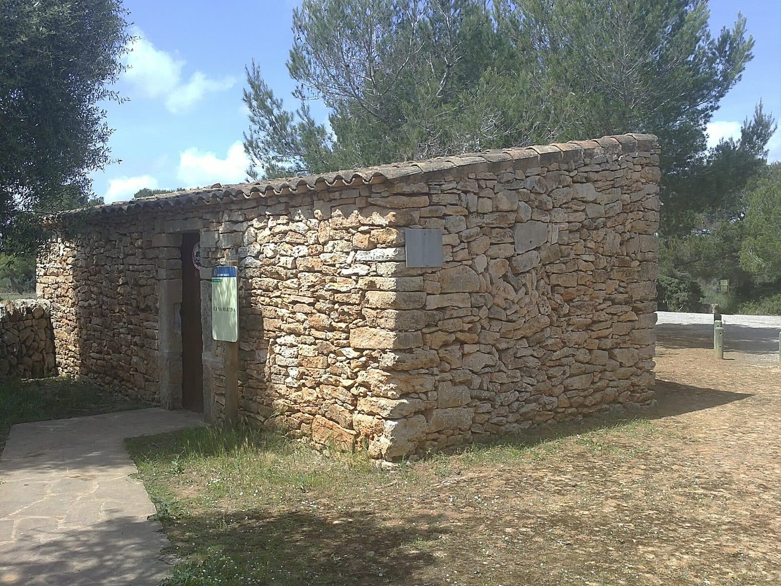
.jpg)
Ca na Martina here refers to an easy hike along Mallorca’s southeast coast. The route is listed as Ca na Martina – Cala Mondragó – S’Amarador – N’Amera. The focus is therefore not a single building, but a scenic experience among coastal coves and the natural surroundings of Mondragó.
The excursion is especially suitable for travelers who want to add a manageable walk to a beach day. The documented hike is rated easy and has an estimated walking time of around 1.5–2 hours. It is long enough to discover different sections of the coastal landscape, yet short enough for a half-day excursion. Anyone looking for the route on a map should therefore use the names Cala Mondragó, S’Amarador, and N’Amera as reference points.
What to See
The full route name already reveals the character of the excursion: Ca na Martina – Cala Mondragó – S’Amarador – N’Amera. The individual names do not refer to rooms in a museum or parts of a monument, but to scenic points along the hike. Its appeal comes from the transitions between trail, coastline, and coves.
Ca na Martina
Ca na Martina is part of the documented hike. Instead of looking for a monumental entrance or visitor center, you follow a route connecting several coastal places. There is a public parking lot at the beginning, making the hike suitable for an independently planned walk.
For this attraction, the neighboring route destinations are the most reliable identifying features. If Ca na Martina is shown together with Cala Mondragó and S’Amarador, it is the scenic excursion described here.
Cala Mondragó
Cala Mondragó is one of the defining points along the way. It belongs to the natural surroundings of Mondragó, one of the municipality of Santanyí’s best-known excursion areas. The coast in this region is characterized by small sandy coves; the transition from a section of trail to an open cove is precisely part of the hike’s appeal.
The pace of the walk changes at the cove. While making progress is the main focus on the connecting paths, the cove provides a natural place for a break and views over the water. Anyone wishing to combine hiking and swimming should allow additional time, since the stated walking time applies to the route and not to longer stays on the beach.
S’Amarador
S’Amarador is another clearly named coastal destination on the hike. The cove can readily be compared with Cala Mondragó without the two merging into a single stretch of beach: the path from one cove to the next reveals just how varied Mallorca’s southeast coast is. The hike therefore gains its character not from a single viewpoint, but from a sequence of different coastal scenes. N’Amera is also part of the documented route name.
N’Amera
N’Amera is another section of the route and extends the excursion beyond the two better-known coves. The visit is therefore not limited to one beach destination but encompasses several named points in the coastal landscape.
However, military land lies east of the route. Access is prohibited. Turnoffs in that direction should therefore not be regarded as additional opportunities for exploration; the permitted course of the hike remains the one to follow. This warning is more important than looking for supposed shortcuts or viewpoints outside the designated path.
Visiting Ca na Martina
The walk begins without a formal starting point. Once oriented, follow the route through the named points Cala Mondragó, S’Amarador, and N’Amera. Since the route is considered easy, the focus is less on an athletic challenge and more on calmly experiencing the coastal landscape.
Time Needed for the Route
The documented route has an estimated walking time of around 1.5–2 hours. This is a useful basis, but not a complete schedule for the excursion. Breaks in the coves, a swim, or a longer stay by the water require additional time. Anyone who wants not only to hike but also to experience each stop properly should therefore allow considerably more time than the walking time alone.
The hike can be included in a half-day excursion. This is particularly convenient if you intend to visit Calonge, Portopetro, or Cala d’Or afterward. Alternatively, Ca na Martina can form the active part of a beach day: first the hike, followed by a longer stay at one of the coves.
Finding Your Way
The most reliable way to navigate is by using the complete sequence of route names. On the correct route, Cala Mondragó, S’Amarador, and N’Amera appear together as destinations. Before setting out, it is advisable to check the route on a map and keep the map available in case of a weak mobile connection.
Pay particular attention to the eastern side: the military land there must not be entered. A path leading into this area is not a permitted variation of the route.
Access and Visit Planning
No reliable fixed opening hours or admission arrangements are listed for Ca na Martina. As this is a scenic excursion with a public parking lot at the start of the route, you should nevertheless check before traveling whether any current access restrictions, parking regulations, or special local notices apply.
Visitor numbers are influenced mainly by the route’s connection with the coves. Cala Mondragó and S’Amarador are destinations in their own right, so hikers, beachgoers, and visitors to the natural area may all cross paths. Anyone seeking the quietest possible walk should leave enough flexibility rather than squeezing the hike between two tightly scheduled appointments.
Getting There and Parking
The long-distance driving information leads as far as Calonge, not directly to the Ca na Martina route. The final section continues from the Calonge area toward the coast and the natural surroundings of Mondragó. For precise navigation, Cala Mondragó and S’Amarador should therefore be used as map destinations alongside Ca na Martina.
From Palma Airport
The road distance from Palma Airport to Calonge is 54 kilometers. The journey takes around 49 minutes via the Ma-19. Calonge serves as a reliable reference point in the hinterland of the southeast coast; from there, continue driving toward the hike.
From Central Palma
The road distance from central Palma to Calonge is 60 kilometers. The journey via the Ma-19 takes around 57 minutes. These figures also apply expressly only as far as Calonge. Additional driving toward the coast is required for the final section to the attraction.
The Ma-19 is the key road connection for most of the journey. Navigation becomes more detailed only in the southeast. Here, the familiar names Mondragó and S’Amarador are usually more helpful than entering Ca na Martina on its own.
Parking and Bus Services
There is a public parking lot at the beginning of the hike. This does not guarantee that a space will be available; flexible planning may be advisable, especially when the coves are also attracting many visitors. Current signs and local parking regulations take precedence.
Bus stops recorded in the wider area include Cala Mondragó, Sa Barca Trencada, Portopetro 1, and Portopetro 2. The Cala Mondragó stop is the closest geographical match for the hike’s scenic destination. As the walk from a stop to the exact trail entrance may vary depending on the chosen access point, check the connection, including the final section on foot, before traveling.
Bus lines to Ca na Martina at a glance
| Line | Route | Departures/day | First | Last |
|---|---|---|---|---|
| 521 | Cala d'Or - Cala Mondragó | 66 | 08:30 | 20:50 |
| 515 | Cala d'Or - Campos | 57 | 05:55 | 23:00 |
| 515e | Cala d'Or - Palma | 10 | 09:27 | 20:10 |
From the official GTFS feeds (TIB/SFM), no real-time data. The figures cover all stops in the town; weekend and holiday services differ — check with the operator before travelling.
Getting there by bus
Cala Mondragó (57024) · 0.5 km as the crow flies
- 521Cala d'Or - Cala Mondragó · Daily
Sa Barca Trencada (57023) · 0.9 km as the crow flies
- 521Cala d'Or - Cala Mondragó · Daily
Portopetro 2 (57052) · 1.9 km as the crow flies
- 515Cala d'Or - Campos · Daily
- 515eCala d'Or - Palma · Mon-Fri
- 521Cala d'Or - Cala Mondragó · Daily
Portopetro 1 (57051) · 1.9 km as the crow flies
- 515Cala d'Or - Campos · Daily
- 515eCala d'Or - Palma · Mon-Fri
- 521Cala d'Or - Cala Mondragó · Daily
Timetable data: official GTFS feeds (TIB/EMT), no real-time — check with the operator before travelling.
Nearby Places
Between the rural hinterland and the varied coastline lies a region where a short hike can easily be combined with very different experiences. Calonge, Mondragó, and Portopetro represent three sides of the southeast: village, natural area, and harbor.
Calonge
Calonge belongs to the municipality of Santanyí and lies at the foot of the final heights of the Serra de Llevant. Historically, the village was shaped by agriculture; fishing also played a role through its associated coastal area. Today, part of the population works in tourism along the nearby coast, while Calonge itself has retained its village scale.
The written history of the village dates back to the Middle Ages. In the 13th century, the settlement appears under the historical name Alqueria Collonia or Alqueria Coloia. It was probably named after Gilabert de Cruïlles, a Catalan nobleman who participated in the conquest of Mallorca. Today, the church of Sant Miquel forms the center of the village.
Mondragó and S’Amarador
The natural surroundings of Mondragó are the most obvious addition to the excursion because the route itself passes through this coastal setting. Anyone with time after the hike can stay at Cala Mondragó or S’Amarador instead of immediately continuing elsewhere. This turns the walk and the beach visit into two clearly separated parts of the same day.
The coves in the municipality of Santanyí are known for their small sandy beaches and clear, turquoise-looking water. Even so, Ca na Martina is worth seeing as more than just an approach route to a swimming stop. Only the path between the named coastal points reveals how close the individual coves are to one another while still being separated by stretches of land.
Portopetro and Cala d’Or
Portopetro is a good choice for a subsequent detour if you would like to visit a harbor town after the hike. Its fishing and yacht harbor provides a clear contrast to the coastal walk. Cala d’Or also lies in the nearby coastal region and is livelier and more tourism-oriented, while Calonge can serve as a quieter stop in the hinterland. Depending on your interests, the hike can therefore be combined with village life, a harbor atmosphere, or a longer stay on the coast.
The place it belongs to
Calonge in the place guidePractical Information for Your Visit
The hike is rated easy and has an estimated walking time of 1.5–2 hours. Anyone wishing to swim should allow more time.
Visiting with Children
Its classification as an easy hike generally makes it suitable for a manageable family excursion. However, the children’s age, stamina, and attentiveness remain important. The walking time of 1.5–2 hours becomes considerably longer with breaks, especially if Cala Mondragó or S’Amarador is planned as a swimming stop.
Before setting out, clarify the permitted route together. The military land to the east is off-limits and must not be entered, even as a supposed shortcut. A saved map is particularly helpful on a family excursion, ensuring that spontaneous changes of direction do not lead to unnecessary detours.
Planning Your Time
Anyone who allows only for the stated walking time can easily underestimate the time spent along the way. A break at the cove, changing for a swim, and continuing along the trail all require additional flexibility. The excursion feels more relaxed when every stop does not have to be reached under time pressure.
What Ca na Martina Is Not
Do not expect a museum, a historic interior visit, or a single monument with a clearly defined visitor circuit. Ca na Martina is part of a scenic route here. The actual visit unfolds along the trail through Cala Mondragó, S’Amarador, and N’Amera. Combining these terms is the most reliable way to find the correct destination.
Local insider tips
Search Using the Route Names
When searching the map, also enter Cala Mondragó, S’Amarador, and N’Amera. The name Ca na Martina alone may lead to a vacation villa, restaurant, or accommodation in the region.
Allow Extra Time for the Coves
The stated 1.5–2 hours refer to the hike. Allow considerably more time for breaks or a swim at Cala Mondragó and S’Amarador.
Do Not Enter the Eastern Side
Military land lies east of the route, and access is prohibited. Turnoffs leading there are neither scenic loops nor permitted shortcuts.
Combine It with Portopetro
After the scenic walk, Portopetro provides a contrasting experience. The fishing and yacht harbor is in the same coastal region, but the restaurant Ca’n Martina there is a different place.