
Collet d'en Morera Viewpoint near Banyalbufar
.jpg)
Collet d'en Morera is a viewpoint near Banyalbufar in southwestern Mallorca. Its appeal lies less in a single structure than in its location: from here, you can take in the landscape that makes Banyalbufar unmistakable—mountains, a coast that drops steeply to the sea, and agricultural terraces arranged across the slopes. These terraces in particular give the view depth. Instead of a uniformly vegetated mountainside, the slope appears divided into many narrow levels. Walls, cultivated plots and landforms tell the story of a cultural landscape that was not merely admired but farmed and supplied with water over a long period.
The viewpoint is therefore especially suited to travelers who want to read the landscape rather than simply take a panoramic photo. It makes a peaceful stop on a trip along the Tramuntana coast and can easily be combined with a walk through Banyalbufar. Anyone expecting a museum, exhibition or historic monument, however, will misunderstand the character of the place: the focus is on the interplay between the sea, the slopes and terrain shaped by human hands.
What to See
The Terraces of Banyalbufar
The agricultural terraces are the most distinctive feature of the surroundings at Collet d'en Morera. They divide the steep slopes into numerous horizontal steps and reveal how intensively the terrain was developed for cultivation. From this elevated perspective, the individual plots do not look like random parcels but like parts of a large system adapted to the topography.
The roots of this landscape lie in Banyalbufar’s Andalusian past. The historic settlement structure included terraces and a network for collecting and distributing underground water. The viewpoint is therefore not only a place for expansive views but also a good location from which to understand the logic of this cultural landscape: the slope was not leveled but made usable step by step. What stands out in the terrain is less individual ornamentation than lines and transitions. Walls follow the contours, narrow plots lie one above another, and the form of the mountains remains constantly visible between the cultivated areas. Letting your gaze move slowly across the slopes makes it easier to understand why terraces and water management became so important to Banyalbufar.
The Coast
Below the higher ground runs a rugged coastline that extends within the municipality from Racó de s'Algar to Port des Canonge. The contrast between the orderly terraces and the irregular coastal relief largely defines the landscape’s impact: on one side are the steps created by people, while on the other are the steep natural formations beside the sea.
Collet d'en Morera is therefore not a viewpoint where you simply look for one distant landmark. More interesting is the spatial relationship between the different parts of the landscape: the mountains above, the segmented slopes below them and finally the coastline. Different layers come to the fore depending on the direction of your gaze. The panorama is best appreciated by pausing rather than moving on immediately and calmly observing how the terrain is arranged in successive levels.
The Serra de Tramuntana
Banyalbufar lies in the southwestern part of the Serra de Tramuntana, between the areas of Estellencs, Esporles and Valldemossa. At Collet d'en Morera, the mountains are therefore more than a distant backdrop: they also explain why the settlement, agriculture and transport routes had to respond so closely to the relief.
The viewpoint conveys this connection particularly directly. The sea forms part of the scene, yet the landscape remains distinctly mountainous: slopes drop steeply, cultivated plots occupy artificially created levels, and the settlement has to adapt to the limited amount of flat ground. This overall composition is precisely what makes Collet d'en Morera special.
Visiting Collet d'en Morera
There is no prescribed route at Collet d'en Morera that must be followed step by step. A visit is about arriving, getting your bearings and looking again. At first, the broad form of the coast usually catches the eye; after that, the terrace walls, layered slopes and transitions between cultivated land and mountains become clearer.
How much time is worthwhile therefore depends greatly on the type of excursion. The site can be included as a brief scenic stop during a drive along the Tramuntana coast. Anyone taking photographs, studying the terraces more closely or walking through Banyalbufar afterward, however, should avoid treating the visit as a tightly scheduled activity. A fixed visit duration would say little about a viewpoint that can be experienced freely.
No fixed opening hours or admission fee are listed for Collet d'en Morera. Before traveling there, it is advisable to check current local information, especially if the visit is tied to a particular daily schedule or bus connection. At a viewpoint, clear visibility and general conditions on site are also more important than a rigid sightseeing plan.
There is no reliable information about regularly recurring peak visiting times, so it would not be reasonable to name a supposedly guaranteed quiet hour. Anyone wishing to avoid crowds should not fit the viewpoint into a narrow time slot but keep the schedule flexible. This leaves the option of taking in the view at leisure or extending the visit to include Banyalbufar.
The place reveals itself primarily through careful observation. A first glance takes in the panorama, a second the terraces, and only afterward do the many boundary lines between walls, slopes and coast become visible. Precisely because no exhibition directs your attention, it is worth treating the landscape itself as the subject of the visit.
Getting There and Parking
The stated road distances and driving times lead to Banyalbufar, not directly to Collet d'en Morera. The route from Palma Airport to Banyalbufar covers 39 kilometers by road; the journey takes around 77 minutes and follows the Ma-20, Ma-1110 and Ma-1120. For the final approach to the viewpoint, use its precise map location.
Banyalbufar is 34 kilometers by road from central Palma. The journey takes around 82 minutes and follows the Ma-1110, Ma-1120 and Ma-10. The relatively long driving time compared with the distance reflects the nature of the Tramuntana approach: what matters is not only the number of kilometers but also the route through the mountains and the approach to the coastal village.
When planning the final section, distinguish between Banyalbufar as the destination and the actual viewpoint. The place name alone is not enough to reach Collet d'en Morera directly. For finding parking, the precise location of the viewpoint is also more useful than general navigation to the village center. Current signs and local traffic regulations should take priority over a fixed route description.
Banyalbufar and the nearby coastal area are also served by bus stops. Anyone arriving by public transport should check in advance which stop is suitable for their chosen approach to Collet d'en Morera and what the final section involves. The mere proximity of a bus stop does not remove the need to check the walking route, especially because the terrain around Banyalbufar is characterized by slopes and significant changes in elevation.
The journey itself is already part of the landscape experience. The closer you get to Banyalbufar, the clearer it becomes how tightly the road, settlement and terraces fit between the mountains and the coast. Nevertheless, attention on the winding roads should remain focused on traffic; the viewpoint itself is the appropriate place for longer looks.
Bus lines to Collet d'en Morera at a glance
| Line | Route | Departures/day | First | Last |
|---|---|---|---|---|
| 202 | Estellencs - Palma | 157 | 06:42 | 21:31 |
| 131 | Santa Ponça - Banyalbufar | 14 | 11:17 | 16:21 |
From the official GTFS feeds (TIB/SFM), no real-time data. The figures cover all stops in the town; weekend and holiday services differ — check with the operator before travelling.
Getting there by bus
Torre des Verger (7004) · 0.4 km as the crow flies
- 131Santa Ponça - Banyalbufar · Daily
- 202Estellencs - Palma · Daily
Banyalbufar 1 (7002) · 0.8 km as the crow flies
- 131Santa Ponça - Banyalbufar · Daily
- 202Estellencs - Palma · Daily
Banyalbufar 2 (7003) · 0.9 km as the crow flies
- 131Santa Ponça - Banyalbufar · Daily
- 202Estellencs - Palma · Daily
Miramar 1 (7015) · 1.3 km as the crow flies
- 131Santa Ponça - Banyalbufar · Daily
- 202Estellencs - Palma · Daily
Miramar 2 (7006) · 1.3 km as the crow flies
- 131Santa Ponça - Banyalbufar · Daily
- 202Estellencs - Palma · Daily
Planícia (7014) · 1.6 km as the crow flies
- 131Santa Ponça - Banyalbufar · Daily
- 202Estellencs - Palma · Daily
Timetable data: official GTFS feeds (TIB/EMT), no real-time — check with the operator before travelling.
Nearby Sights
Banyalbufar is the most natural addition to Collet d'en Morera because the village and its slopes continue what appears as a landscape panorama from the viewpoint. On a walk afterward, the terraces are no longer seen only from above or at a distance. Walls, lanes, gradients and small cultivated plots draw closer together and show how strongly life in the village has adapted to the terrain.
The village’s history reaches back to an Andalusian community. In the 10th century, a farmstead named Banyalbahar existed here. Terraces and water distribution shaped the area’s subsequent development. After Mallorca was conquered by King Jaume I in 1229, Muslim rule ended, but the agriculturally shaped landscape remained a defining feature of Banyalbufar.
Anyone wishing to expand the excursion thematically can combine the viewpoint with Banyalbufar’s historic center, terraces and winemaking tradition. The Malvasía grape is a particularly important part of the village’s agricultural identity and is cultivated again today. The route thus leads from the broad impression of the landscape at Collet d'en Morera to the specific uses that have shaped these slopes over a long period.
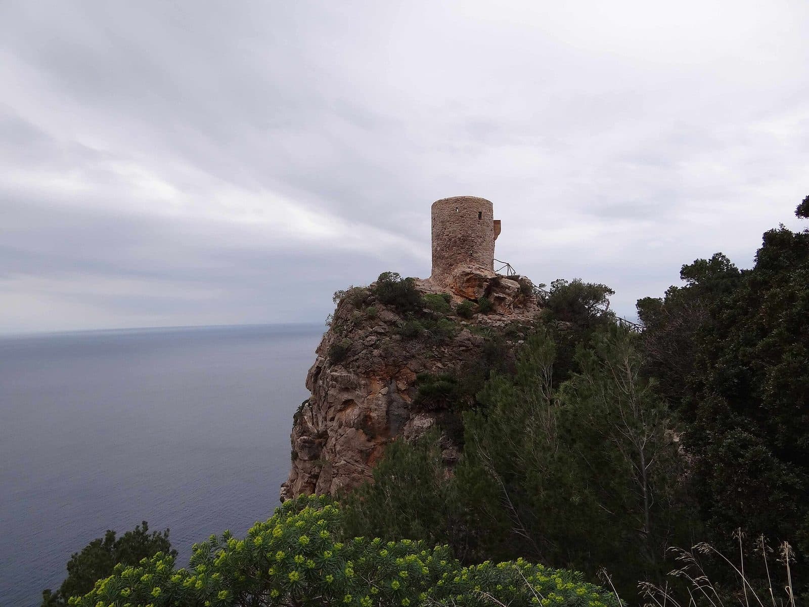
Torre des Verger, also known as Mirador de ses Ànimes, can be included as another stop in the coastal landscape. The historic watchtower recalls the period when the coast had to be monitored for attacks by pirates and corsairs. It should not, however, be confused with Collet d'en Morera: both places offer views of the landscape, but they are separate destinations with different characters.
For a well-balanced excursion, there is no need to overload the surroundings with too many distant stops. The viewpoint, the terraces and Banyalbufar already tell a coherent story: one of a steep coast, limited farmland and the human ability to adapt water and soil management to difficult terrain.
Local insider tips
Follow the Lines Across the Slopes
Do not look only at the sea: the lines of the terrace walls are particularly revealing. They show how Banyalbufar’s slopes were made usable step by step for agriculture and water distribution.
Combine It with Banyalbufar
After the panoramic view, it is worth changing perspective in the village. Among the lanes, gradients and terraces, the broad landscape panorama becomes a cultural landscape that can be experienced up close.
Treat the Watchtower as a Separate Sight
Torre des Verger is a separate destination, not another name for Collet d'en Morera. When combined with the viewpoint, however, it helps explain why the steep coast also had to be strategically monitored in the past.