
Torrent de Pareis Viewpoint near Cala Tuent
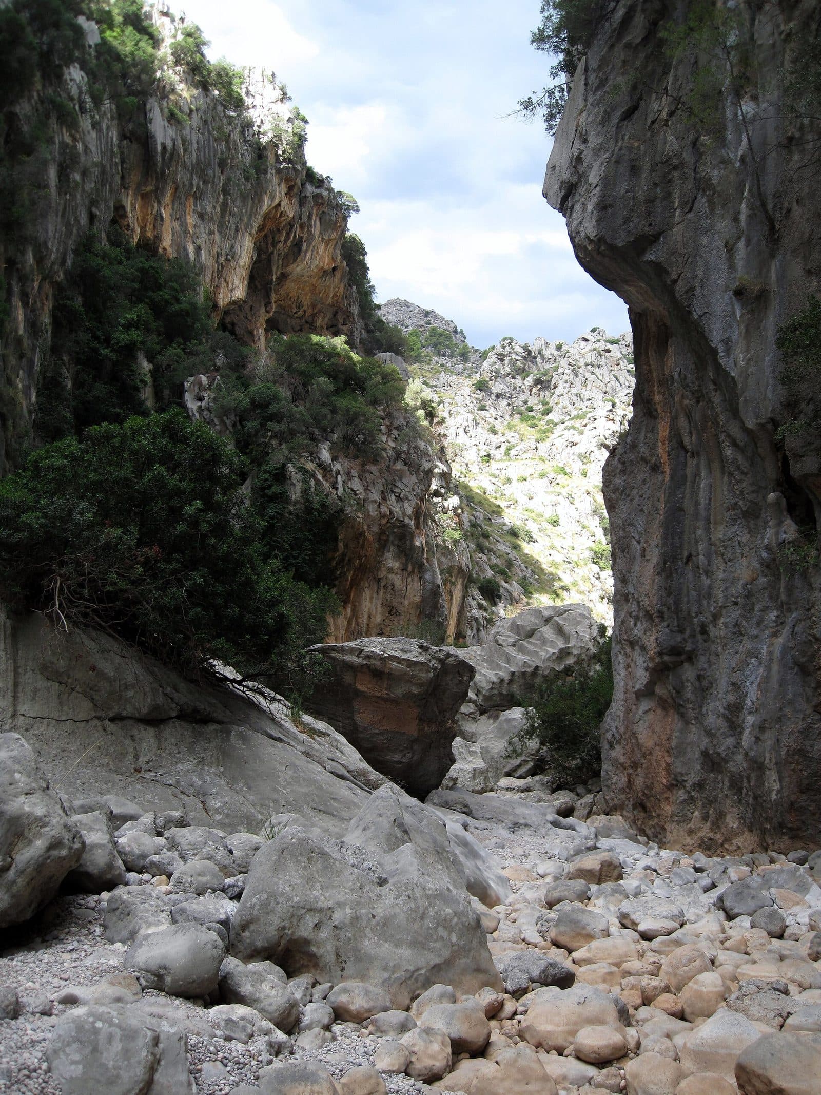

The Torrent de Pareis reveals a side of Mallorca that has little in common with the shallow swimming coves of the south. From the viewpoint near Cala Tuent, the view extends across a landscape in the northwest of the island shaped by limestone, erosion, and steep mountain slopes. Even the long drive through the Serra de Tramuntana makes it clear how remote this stretch of coast is.
The viewpoint is primarily a place to observe and understand the landscape. Sharp rock formations, deeply cut valleys, and the Mediterranean at the edge of mountains that descend directly to the coast define the scene. Changing light causes contours to emerge and disappear again; after rain, water also alters the character of the otherwise often dry torrents.
It is important to distinguish between the viewpoint near Cala Tuent and the complete crossing of the gorge of the same name. The demanding route through the streambed begins elsewhere, leads over large boulders and climbing sections, and ends at the mouth near Sa Calobra. A stop at the viewpoint, by contrast, is an opportunity to observe the landscape without attempting to walk through the canyon.
This makes the location suitable for travelers who want to discover the geological character of the Tramuntana without immediately undertaking a difficult mountain tour. Photographers will find distinct forms and broad landscape lines; those who enjoy slow travel have good reason to see Cala Tuent not merely as a swimming cove but as part of a larger mountain region.
History and significance
Long before paths and roads brought visitors to this part of Mallorca, water was the main force at work here. The Torrent de Pareis formed in the limestone of the Serra de Tramuntana through erosion, abrasion, and the karst dissolution typical of limestone landscapes. Torrential rainfall entered fissures, dissolved rock, and carried loose material onward. Existing fractures thus developed into a gorge with caves, crevices, depressions, and steep rock walls.
The shaping force of water
The name “Torrent” should not be confused with a river that flows steadily throughout the year. The watercourse does not always contain water. This irregularity is a defining characteristic: after heavy or prolonged rain, the dry streambed can take on a completely different character within a short time. Underground water levels also influence whether pools or flowing sections form later.
In places, the rock walls reach heights of up to 200 meters. The viewpoint near Cala Tuent does not reveal the entire route; instead, it makes it possible to understand the natural forces behind this deeply dissected mountain landscape.
The Tramuntana natural environment
The gorge and its surroundings provide habitats for endemic plants. One of the natural area's most characteristic animals is the Ferreret, a midwife toad found only in the Balearic Islands.
The seemingly indestructible rock walls enclose a sensitive ecosystem. Plants grow in crevices with little soil, while animals use rocky niches and hard-to-reach water sources. Anyone viewing the landscape from the viewpoint is therefore looking not only at a geological attraction but also at a habitat whose remoteness contributes to its ecological value.
Landmark of a wild island coast
Today, the significance of the Torrent de Pareis extends beyond geology and nature conservation. The gorge represents the Mallorca where mountains and sea meet directly. Its mouth near Sa Calobra, the crossing for experienced mountain hikers, and the surrounding viewpoints provide different ways of experiencing the same landscape. The viewpoint near Cala Tuent is the quieter option: it does not require a complete canyon route but still reveals the scale of the natural environment.
What to see
The first impression is not created by a single feature. The eye moves back and forth between limestone slopes, valley cuts, and the coast until the structure of the terrain becomes clear. Unlike a classic panoramic viewpoint with a clearly defined main subject, the attraction here lies in the interplay of several layers of landscape.
The limestone landscape
Pale, sometimes sharp-edged rock dominates the scene. Over a long period, rainwater has washed out the limestone and shaped it along natural fracture lines. Channels, crevices, and darker depressions interrupt the surfaces. Wherever plants can take root, they appear almost like small islands among the bare rock. This barren surface explains why water not only runs off above ground but also penetrates underground, where it continues to shape the rock.
When the sun is low, edges and folds stand out more clearly, while even midday light makes the rock surfaces appear flatter. It is therefore worth looking beyond the most distant horizon. The nearby rock formations in particular reveal how the larger gorges and torrents of this region were formed.
The cuts made by the torrents
The valleys of the Tramuntana are not gentle hollows. In these mountains, water follows narrow, steep channels and can develop tremendous force after heavy rainfall. Large boulders, narrow passages, and washed-out sections characterize the interior of the gorges.
From the viewpoint, the aim is not to identify individual climbing sections along the gorge route. The broader view of the relief is more revealing. The deep lines in the terrain show how extensively water has divided the limestone. What appears from a distance to be a calm, frozen landscape is the result of recurring and at times extremely violent processes.
Mountains and the Mediterranean
On the northwest coast, the Serra de Tramuntana does not end in a broad plain. Its slopes extend to the sea, and this abrupt transition gives the view its dramatic character. Beyond the rocky foreground, the landscape opens toward the coast; depending on the direction of view and visibility, the Mediterranean appears as a calm surface beside the irregular mountain contours.
Cala Tuent provides an ideal landscape setting for this contrast. The secluded cove lies between high mountains and the open coast. The viewpoint is therefore one of those places where a map suddenly becomes understandable in spatial terms: behind the coastline lies not flat hinterland but a mountain range defined by gorges, ridges, and hard-to-reach valleys.
What the viewpoint is not
The name may create expectations that lead visitors in the wrong direction. The viewpoint is neither the beach at the mouth of the Torrent de Pareis nor the starting point for the complete gorge crossing from Escorca. The experience consists of directly observing the landscape.
Anyone wishing to cross the entire gorge must plan a separate and difficult mountain undertaking. The route involves climbing over large boulders, sliding through narrow passages, and leaving the streambed in places. Good fitness, sure-footedness, a head for heights, and precise route knowledge are essential. The viewpoint near Cala Tuent offers a deliberately different experience: pause, read the terrain, and appreciate the scale of the Tramuntana.
Visiting the viewpoint
A visit usually begins long before the actual stop. The roads into the northwest pass through mountain scenery, and the drive requires more attention than an ordinary coastal route. After arriving at Cala Tuent, it is worth making a conscious transition from driving to observing the landscape slowly. A quick photo captures the forms but rarely the spatial relationship between the torrent, mountains, and sea.
Time to take in the view
No fixed sightseeing itinerary is needed for the viewpoint itself. The amount of time required depends on whether the stop is planned as a brief look at the landscape or combined with Cala Tuent and other stops in the surrounding area. Anyone wishing to take photographs or trace the different lines of the terrain should avoid arriving under time pressure. Cloud shadows and changing light noticeably alter the appearance of the rock walls.
Crossing the gorge is a separate, difficult hike and not an extended final section leading to the viewpoint.
Light and crowds
Early light is especially appreciated at Cala Tuent and along the neighboring Tramuntana coast. In the morning, shadows define the mountain forms more clearly, while the surroundings have not yet been affected by the day's heat. Anyone seeking a peaceful impression of the landscape therefore has good reason to set out early. However, driving at night on the winding mountain roads requires particular concentration.
The viewpoint can also be rewarding later in the day when the sun strikes the contours from the side. Clear visibility matters more than any single perfect time. Low clouds can obscure parts of the relief; after rain, by contrast, the landscape becomes more dramatic, although streambeds and rocky access points can also become more dangerous.
A stop, not a staged attraction
Opening hours and admission are not included in the current basic information and should be checked before setting out. The true value of the location does not lie in following a prescribed itinerary. A few steps, a different angle, and enough time to trace the mountain lines are all that is needed to appreciate the place.
Getting there and parking
The journey leads deep into the Serra de Tramuntana and is part of the experience. The following route details expressly apply as far as Cala Tuent, not to an exactly marked parking position at the viewpoint. The final section should be planned using current local signs and the location data displayed on the page.
From Palma Airport
The road distance from Palma Airport to Cala Tuent is 72 kilometers. The drive takes around 105 minutes and follows the Ma-30, Ma-13, and Ma-2130. The journey time is not explained by distance alone: after the faster roads through the island's interior come winding mountain sections where slower and more cautious driving is required.
The route leads from the broad basin around Palma into increasingly steep terrain. With each stage, limestone mountains, narrow valleys, and blind bends become more prominent. Anyone arriving directly after a flight should not underestimate the long mountain drive and should allow enough concentration for the final section.
From central Palma
The road distance from central Palma to Cala Tuent is 69 kilometers. The drive takes around 109 minutes and follows the Ma-13 and Ma-2130. Although the route is slightly shorter than from the airport, the measured driving time is marginally longer. The same applies here: the route details end in Cala Tuent, and the precise access to the viewpoint must be considered separately.
The Ma-2130 provides access to the central part of the Tramuntana toward Lluc and Escorca. In the mountains, bends, oncoming traffic, and possible cyclists determine the pace. Extra time is more sensible than a tightly scheduled day, especially because photo stops and views along the way can easily take longer than expected.
Parking and public transport
No bus stop has been recorded in the immediate vicinity of the viewpoint. Visitors should therefore not assume that a direct scheduled bus connection to the destination is available for a spontaneous trip. Anyone traveling without their own vehicle must clarify the entire connection, including the final section, in advance.
Consideration is particularly important when parking. Narrow mountain roads and access routes must not be obstructed; even apparently empty pull-offs may be needed as passing places or emergency access routes. Local signs and clearly designated parking areas must be followed. The scenic appeal of the region is no justification for stopping on blind bends or access roads.
Nearby places
Cala Tuent is more than a location reference for the viewpoint. The secluded cove displays the same fundamental contrast as the Torrent de Pareis: the steep Tramuntana mountains on one side and the open Mediterranean on the other. Instead of dense development, rock, vegetation, and the sheltered form of the coast shape the scene.
Cala Tuent
A stop at the cove combines well with the viewpoint because the forms visible from higher ground can be observed there from a different perspective. Below, the mountains seem to draw closer together; the eye follows the slopes upward instead of looking outward from them. The beach consists of natural coastal material and lies in a noticeably quieter setting than many easily accessible resort beaches.
Cala Tuent should nevertheless not be treated merely as an addition to a long driving route. Its secluded location, mountain backdrop, and the journey there justify allowing extra time. Combining the viewpoint with the cove makes it easier to understand how directly the Tramuntana meets the sea along this stretch of coast.
Escorca and Lluc
Escorca and Lluc lie in the mountainous hinterland. Continuing in this direction connects the viewpoint with the central mountain region without automatically turning the outing into a hike through the canyon.
Lluc serves as a useful point of reference in the central mountains. The road through this part of the Tramuntana offers further views of limestone peaks, valleys, and the traditional cultural landscape. For a day trip, it is advisable to choose a small number of stops carefully rather than underestimate the driving times on the winding roads.
Sa Calobra and the mouth
At Sa Calobra, the Torrent de Pareis reaches the Mediterranean. This is not the viewpoint near Cala Tuent but the other end of the natural landscape of the same name. Anyone wishing to combine both locations in a single day should plan them as separate destinations. Mountain roads mean that places appearing close together on a map do not automatically make for short stages.
A visit to the mouth requires additional driving and walking time. Crossing the complete gorge is not necessary.
The place it belongs to
Cala Tuent in the place guidePractical information for your visit
The most important practical point is that the viewpoint and the canyon hike are two different undertakings. A scenic stop near Cala Tuent should not be confused with the route from Escorca through the streambed to Sa Calobra. Ordinary walking shoes and a spontaneous sense of adventure are expressly not sufficient for the latter.
Weather and water levels
The Torrent de Pareis does not always contain water. However, this by no means makes a dry streambed permanently safe. After heavy or prolonged rain, water, wet rocks, and remaining pools can change conditions. For the viewpoint, this mainly affects visibility, road conditions, and the choice of a safe place to stand; for a gorge tour, the water level is a crucial safety factor.
Low clouds can severely restrict the view. Clear days are better for seeing the layered mountain ranges. At the same time, the terrain offers little reason to underestimate the summer sun. Water, sun protection, and a hat should therefore be kept in the vehicle or day pack even for a supposedly brief landscape stop.
Footwear and terrain
Sturdy footwear with grippy soles is the sensible choice whenever paved surfaces are left or rocky edges are entered. Limestone can be slippery, loose, or sharp-edged. A better camera angle does not justify climbing over unsecured edges or venturing into steep terrain.
The complete gorge crossing has considerably greater requirements. It involves climbing over boulders, moving through narrow passages, and sometimes searching for route markers. Sure-footedness, a head for heights, good fitness, and route knowledge are essential; without experience, professional guidance is recommended.
Visiting with children
As a scenic stop, the location is easier to include in a family outing than the difficult canyon route. Adults must closely supervise children near roads, rock edges, and terrain with limited visibility.
Crossing the Torrent de Pareis is not an ordinary family hiking route. Climbing sections, large boulders, slippery passages, and dependence on the weather require a separate assessment based on experience and ability. For a straightforward visit with children, viewing the landscape and spending time at Cala Tuent are the more obvious options.
Respecting the natural environment
Plants growing in rock crevices may appear robust, but they grow under difficult conditions and recover slowly. Paths and already used standing areas should therefore not be left in search of supposedly better viewpoints. All litter must be taken away. Stones should not be moved, and markings should not be added.
The stop is best appreciated through its forms, light, and the scale of mountains that descend directly toward the coast at this point.